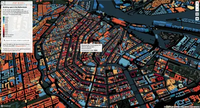
SAN FRANCISCO--Mapbox just updated the entire world with fresh satellite imagery, totaling 135,000,000 km² of satellite imagery from Maxar Technologies (TSX:MAXR), the leader in Earth Intelligence and Space Infrastructure. The new data is from Maxar’s WorldView satellites — the most advanced, highest-resolution Earth observation instruments of their kind. The high-resolution imagery includes beautiful colors and textures, making it great for finding landmarks during a run on Strava, optimizing delivery times on Straightaway by zooming in on the last 100 feet, seeing snow storms forming along the coastlines in British Columbia with The Weather app, visualizing the landscape while reading National Geographic, and even seeing a real-time heatmap of what’s happening in a city on Snapchat.
“The world is beautiful, which is why we are working with Maxar to deliver its most accurate representation to our customers. Maxar builds excellent satellites, which are producing the highest quality imagery available today,” said Eric Gundersen, Mapbox CEO. “By incorporating the high-resolution satellite imagery, we are able to offer 3D maps that are far more advanced and detailed than anything else. The maps look stunning!”
This imagery, combined with the recent launch of Mapbox 3D, is the canvas for creating totally custom maps for the web and mobile. Now all maps are in 3D: the camera’s view of the map is controlled through the newly launched Camera API, and the sun’s position is simulated based on geographic location and time of day.
“We’re excited to continue our long partnership with Mapbox,” said Dan Jablonsky, Maxar CEO. “With the integration of Vivid Basic into their platform, Mapbox continues to raise the bar for providing end users with beautiful and accurate maps. When our next-generation WorldView Legion satellites launch, we will significantly expand our collection capacity supporting 3D model generation for the most accurate and up to date foundation data for mapping products."
The combination of Maxar’s image quality, volume, and recency — together with the launch of Mapbox 3D — transforms the interactive map experience. This imagery lets you read runway markings, count cars and shipping containers, and see inside buildings under construction. To enable the realistic views this new imagery offers, Mapbox has released new APIs to deliver greater controls for developers:
Camera API: The Camera API is the free form low-level API for controlling the camera and its view of the map. This increases the map’s maximum pitch from 60 to 85 degrees. This provides access to the low-level camera code for developers to fine-tune details where the map can be tightly coordinated with other UI elements, transitioning smoothly and precisely, framing the right content in the viewport.
High Performance DEM (Digital Elevation Model): Terrain tile sizes are now reduced by 50% on average compared to the legacy terrain-rgb data, corresponding to a 35% improvement in hillshade layer rendering. Improved map load by 30% on average, and in some styles more than 50%, through improved prioritization of resource loading and task distribution.
Sky API: The new Sky API, allows the map to simulate the sun’s position based on geographic location and time of day. Gradient sky layers use color ramps, starting at a distance of 0 from the sky center, and 1 at the sky’s farthest extent. Here the fading is set between 0.8 and 1 to ramp within the visible range.
About Mapbox
Mapbox is a mapping and location cloud platform for developers that provides the building blocks (SDKs and APIs) for real time location awareness into automobiles and applications.
The Mapbox platform creates a feedback cycle, where AI-powered data pipeline processes +300 million miles of anonymized and aggregated live road telemetry data daily — allowing Mapbox to continuously update the map everywhere in the world. The cloud platform shares this live map with developers via its scalable mapping software components (maps, navigation, search) for mobile and web applications, logistics and dispatching, and in-car automotive navigation.
Founded by Eric Gundersen in 2010 in a garage space in Washington, D.C., Mapbox now has roughly 700 million monthly active users touching its maps, a global workforce of 520 employees, and its services power industry leaders, including CNN, General Electric, IBM, Instacart, Lonely Planet, Mastercard, Snapchat, Tableau, and The Weather Channel. Learn more at Mapbox.com
About Maxar
Maxar is a trusted partner and innovator in Earth Intelligence and Space Infrastructure. We deliver disruptive value to government and commercial customers to help them monitor, understand and navigate our changing planet; deliver global broadband communications; and explore and advance the use of space. Our unique approach combines decades of deep mission understanding and a proven commercial and defense foundation to deploy solutions and deliver insights with unrivaled speed, scale and cost effectiveness. Maxar’s more than 4,300 employees in more than 20 global locations are inspired to harness the potential of space to help our customers create a better world. Maxar trades on the New York Stock Exchange and Toronto Stock Exchange as MAXR. For more information, visit www.maxar.com.


